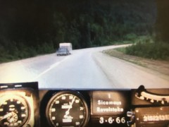
Have you ever wondered what the Trans Canada Highway looked like in the ’60s?
The Ministry of Transportation and Infrastructure compiled a grouping of nostalgic 16mm camera that took snapshots every 80 feet, and they were compiled together to form this film.
According to TranBC, “The ‘Highways Department’ (as it was then known) was the first organization in Canada to collect information this way in order to create a visual record of road condition information from across the province, thereby allowing our engineers to study a stretch of road without having to travel there.”


