In Pictures: Travelling the slow way to 3 Valley Gap
By Laura Stovel
In recent years I have become aware of how little I know of my own surroundings. I was born in Revelstoke and have driven on the Trans-Canada Highway hundreds of times but I have never stopped at the lakes along the route west. Until last weekend I couldn’t even say where the Bell Pole yard was, even though I’d heard about it many times. So I decided to walk from Revelstoke to Three Valley Gap.
My interest in the history of the area also motivated me. Lately I’ve been reading historical descriptions of the land between the Big Eddy and Three Valley Gap by travellers like James Turnbull, who surveyed the land with Walter Moberly in 1866 and by Sir Sanford Fleming who walked the same route in 1883, skillfully guided by a Sinixt man named Baptiste.
Turnbull wrote about “large granite boulders (that) are strewn about the benches in every direction” about “four miles west of the Columbia.”
Fleming wrote about the men that came to meet them from Kamloops having to wade through a large bog “up to their middle for the greater part of the way” as they approached the Big Eddy from Three Valley Gap. He wrote, “Do any of my readers know what it is to wade through a marsh of deep oozy mud, covered with stinking water?” Baptiste, knowing the land well, was able to guide them on a path used by his people which avoided such obstacles.
I wanted to see these boulders and marshes and grieve the loss of “cedars, four feet in diameter, (that) rise up around us like columns of a lofty temple” near the summit of the pass. I wanted to see the majestic lakes that Fleming described, slowly and with awe and attention.
So last Saturday I booked myself a room at the Three Valley Gap resort, met a friend for breakfast and set off at 9:25. It was a beautiful day for walking, sunny but not too hot. The following photos and captions share some of my observations along the way.
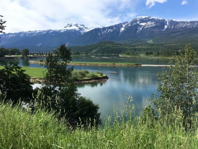
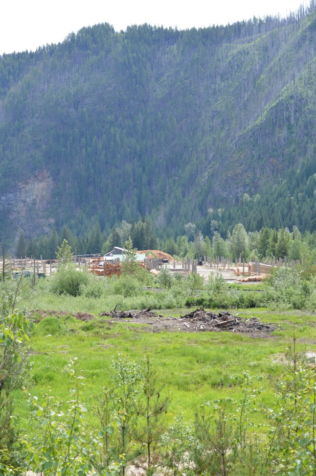
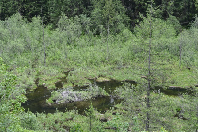
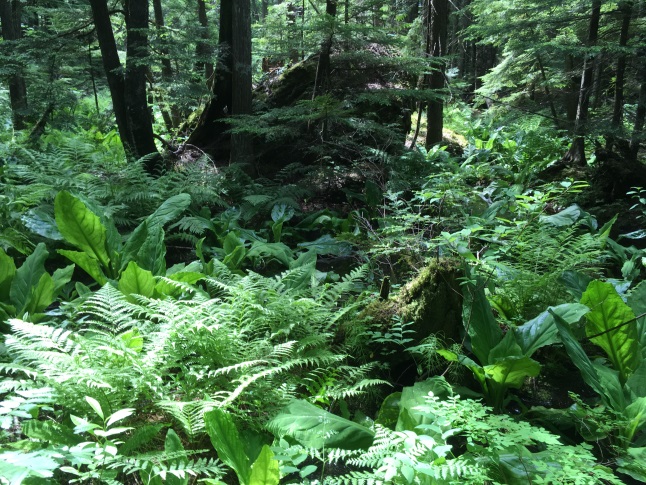
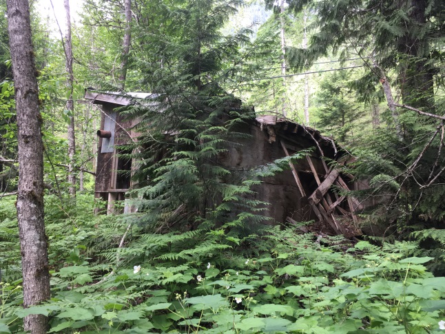
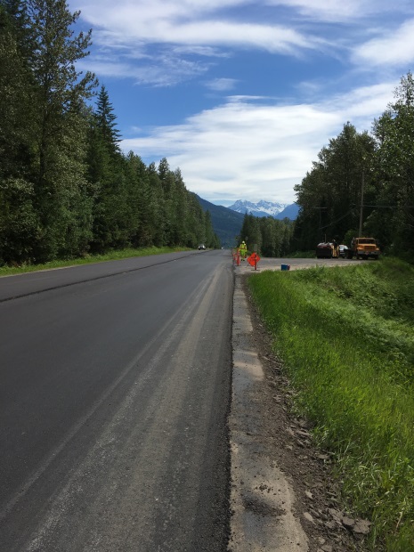
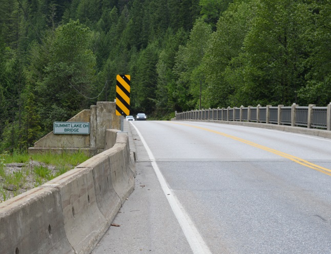
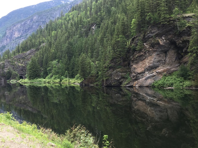
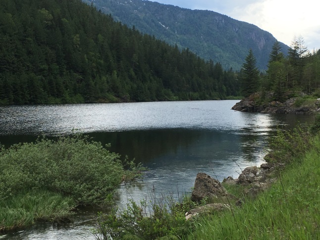
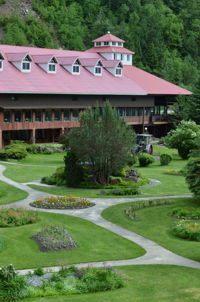
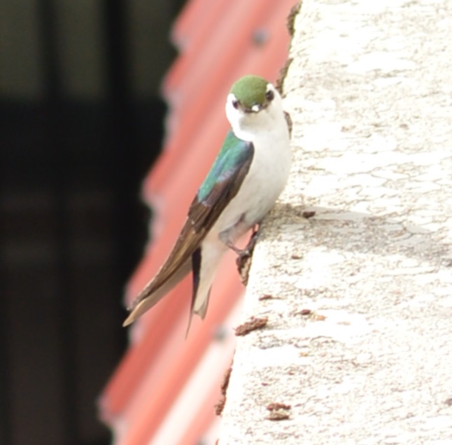
It was a beautiful day for a long walk. It was appropriate to start at the Columbia River which was the main transportation route for indigenous people and settlers for centuries, if not millennia. Laura Stovel photoTravelling the slow way allowed me to notice the saw mills and shingle mills along the way. I had never noticed the Bell Pole yard before or other small mills on the south side of the highway. Laura Stovel photoOn the way to Summit Lake there was plenty of marshland, complete with beaver dams that would have presented a formidable challenge to those who had to walk through in the 1800s. Laura Stovel photoOne of the highlights of my trip was getting off the highway and walking through the woods. This slowed my journey, but that was the point and the views were rewarding. In 1866, James Turnbull wrote about “large granite boulders (that) are strewn about the benches in every direction” about “four miles west of the Columbia.” Laura Stovel photoA beautiful patch of ferns and skunk cabbage amidst mossy boulders and trees. Sanford Fleming wrote about his trip in 1883, “The vegetation around us was rank, with a green, luxurious growth of mosses. Indeed the mosses extended in all directions, the surface of the lower branches of the lofty trees not excepted. Some of the ferns we saw were striking, and the abominable devil’s club was in profusion all around us.” Laura Stovel photoAt one time small cabins were scattered through the bush and along the creeks and rivers as settlers and miners set up temporary homes. This cabin, more recently used, is a remnant of such times. Laura Stovel photoJust outside of Revelstoke the highway was being paved. I noticed that the asphalt covered less ground than the previous road. This is especially a problem for cyclists. Photo Laura Stovel. The scariest part of the walk was crossing Summit Bridge where there was very little room on the side of the road. As a walker, I could step onto the ledge just inside the rail but for cyclists crossing the bridge is risky. Laura Stovel photoI enjoyed lunch by Summit Lake with its perfect reflection of the bluff opposite, forming an arrow in the water. Fleming called it Bluff Lake and wrote that “the walking is so difficult that we deem it expedient to form a raft on which we can float to its further end. Laura Stovel photoVictor Lake was just a short distance after Summit Lake and I sat on a lovely, rocky outcrop and enjoyed the view, stepping around a little garter snake that was basking in the sun. Fleming wrote, “the water is like a mirror, in which the lofty peaks are reflected in every variety of shade.” Laura Stovel photoJust before 4:00, after six and a half hours of walking, exploring, and sitting and reflecting, I arrived at Three Valley Gap. I had booked myself a room with a view of the lake and beautiful garden. Each room has a balcony overlooking the garden and, after I showered and napped, I sat out on a chair provided, sipped a cup of coffee and enjoyed the view. Fleming wrote that “Few Swiss lakes, which I have seen in my limited wanderings, rise in my mind as superior to it in wild, natural beauty.” At the west end of the lake they made camp. “Every spot is bright green,” he wrote, but there is not a blade of grass. Possibly owing to the excessive moisture of the locality, the ground is brilliant with rich mosses of the thickness of three or four inches and you walk on them as on a Turkish carpet.” Laura Stovel photoOne of the delights at Three Valley was the colourful birds that flitted around the garden and swooping in at any crackling sound, hoping for a bite to eat. Their feathers were bright green or blue and I didn’t recognize them. Do you? Laura Stovel photo