Some homes and businesses in forested areas in Revelstoke and the adjacent Columbia Shuswap Regional District are at risk from uncontrollable wildfires during high and extreme fire weather conditions.
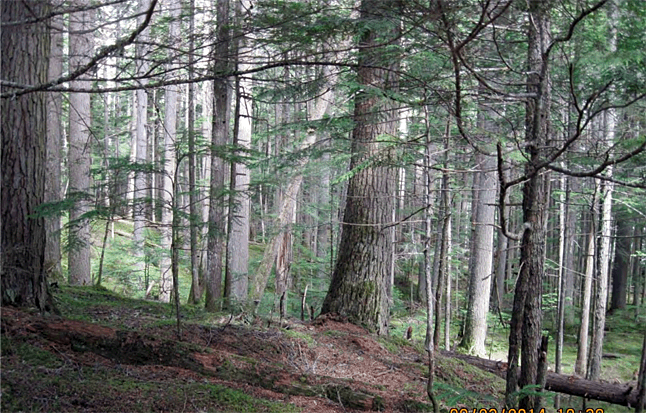
Okay. That comes as no surprise to anyone who has lived here for any length of time. The city is surrounded by fuel-laden forests and it’s not a question of if they’ll go up in smoke, but when.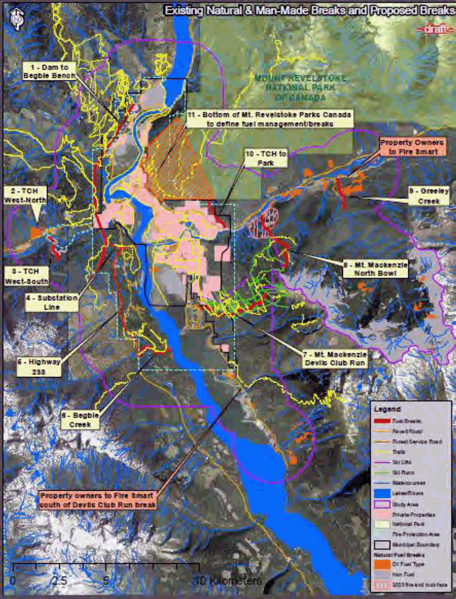
The fact that Revelstoke is in the midst of the Interior Rainforest is somewhat misleading. Just the term ‘rainforest’ can give you the impression that the forest is to wet to burn but that is not the case. There have been two major fires here in the last 100 years – one in 1911 and another in the 1930s – as well as smaller fires, most recently on Mount Mackenzie in 2003 and on Mount Macpherson in 2007.
In preparation for the inevitable big burn, Revelstoke’s Community Wildland Fire Protection Committee has designed a network of fuel breaks to reduce this risk for some areas and is now inviting members of the community to comment on the draft design. (Links to this document as well as to a backgrounder on the wildfire issue are available at the bottom of this story.
Fuel breaks are strategically located strips of low volume fuel where the intensity of an uncontrolled wildfire is lowered so that firefighters can safely put the fire out. This project identifies existing highways, transmission lines, wide ski runs and older forests that create fuel breaks around portions of the community. Areas have been defined where fuel reduction is needed by removing dead materials, pruning trees and reducing tree density to complete a network of effective fuel breaks.
These fuel breaks will not, however, stop wildfires from popping up and property owners need to FireSmart their homes and businesses to reduce wildfire risks.
“We can get high and extreme wildfire conditions here in Revelstoke for 20 days a year on average – and for up to two months in years like 2003,” project member and retired wildfire base manager Archie McConnachie said in a statement. “While fuel breaks will reduce the risks, we all need to ramp up our preparedness and start reducing the wildfire fuels on our own properties.”
The team found that Revelstoke and the surrounding area are fortunate to be surrounded by many natural and man-made areas that meet the criteria for fuel breaks, creating the foundation for an effective fuel break network. These include:
- The main BC Hydro transmission line from Revelstoke dam, across Highway 1 and west of Begbie Bench and the line to the Downie substation where vegetation management is done regularly;
- The Highway 23S and transmission line corridor;
- Old forests along Begbie Creek and Greeley Creek;
- Cleared runs on Revelstoke Mountain Resort (RMR), especially the Devils’ Club and North Bowl runs;
- Recent wildfires in rocky, steep areas to the east and west of the community; and
- Deciduous forests to the west of the City and between Highway 1 and Mount Revelstoke National Park.
There are three gaps in this network:
- South of the developed area of RMR;
- East of Greeley Creek where property owners here and those south go RMR will need to be especially vigilant to FireSmart their properties; and
- Mount Revelstoke National Park – As a member of the City’s Community Wildland Fire Protection Committee Parks Canada recognizes this gap and has drafted a Fire Management Plan that includes an assessment of wildfire risks and options by 2016, with fuel treatment decisions to follow.
The team recommends that these breaks be reviewed every 10 years to ensure they continue to be effective.
People are invited to attend neighbourhood meetings to learn more about how to FireSmart your property and to provide input on the draft fuel break design:
May 26 at 7 pm — Columbia Park, Clearview Heights and Johnson Heights residents meet at the Hillcrest Hotel;
May 27 at 7 pm — Begbie Bench and Macpherson area residents meet at the Nordic Ski Cub; and
May 28 at 7 pm — Arrow Heights and Airport Road residents meet at RMR’s Sutton Place.
Please click here to read the draft report.
Please click here to read a backgrounder on this project.
Wildfire protection assessment began in 2006
The City has been pursuing stronger wildfire protection for almost a decade. Based on recommendations from a 2006 Community Wildfire Protection Plan, the City created the Community Wildland Fire Protection Committee in 2007 to advise the City on wildfire protection activities. The Committee includes representatives from the City, Regional District, provincial agencies, Parks Canada, CPR, RMR and the forest sector, as well as a public representative.
All forested City-owned properties and the areas around the City water works have been assessed for wildfire risks and fuel management has been completed for the two areas that had unacceptable risks.
In 2009 an Enhanced Wildfire Risk Management Report was completed that recommended a high priority for a network of fuel breaks. The City secured funding from the Strategic Wildfire Prevention Initiative of the Union of BC Municipalities and the Ministry of Forests, Lands and Natural Resource Operations as well as CBT for this project. The project is being completed by Archie McConnachie, Cindy Pearce of Mountain Labyrinths Inc. from Revelstoke, and B.A. Blackwell and Associates.
The project includes the Revelstoke Fire Protection Area and forests within two kilometres of the Protection Area as well as the Greeley Creek watershed and portions of Revelstoke Mountain Resort.
For more information please contact Rob Girard, chief of Revelstoke Fire Rescue Services, by phone at 250-837-2884 or by e-mail at rgirard@cityofrevelstoke.com.
Please click here to read a 2011 story about FireSmarting part of the city.
Please click here to read a 2011 story about the threat a major forest fire would pose to Revelstoke.