Last summer the Federal Government announced a two year $10 million trail construction program that was to be administered through the National Trail Coalition (NTC).
The Revelstoke ATV Club member Bob Holland said the club proposed to the NTC a trail rehabilitation project for the Sproat Mountain Lookout Trail. (Please see a description of the project, and a Google Earth map, below.) The total value of the project was estimated at $17,300.
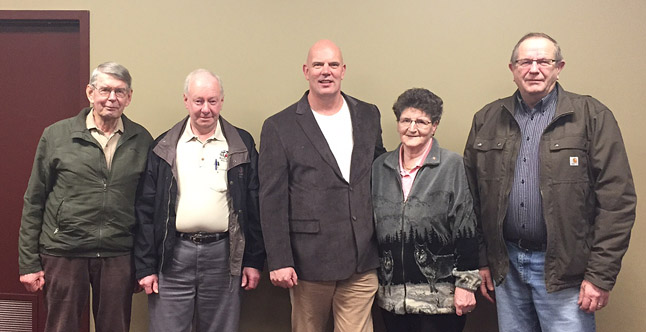
At a meeting with club members on Wednesday, February 11, MP David Wilks formally announced their funding under the NTC program.
The club’s application to the NTC was for $7,150. As BC had over-subscribed for its share of available funding under the NTC program, the project was approved for $5,000. Recreation Sites and Trails BC have also contributed $5,000 to this very worthwhile project.
“It is our plan to submit other funding applications so that we may complete the full scope of proposed work,” Holland said.
Project Description (Background)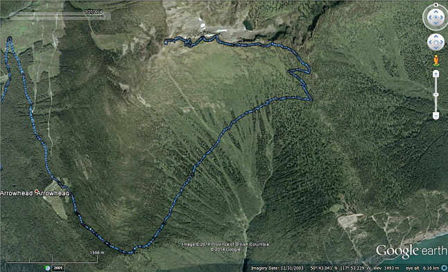
Sproat Lookout Road Access (trail) (as shown in blue on the Google Earth Image) and Lookout structure were originally constructed by BC Forest Service as a replacement to the Mount Cartier Lookout. It is believed that the Mount Cartier Lookout was not officially utilized after 1930.
In September of 1939 a pack trail 10 miles in length was constructed from Arrowhead to the top of the ridge south of Mount Sproat at a cost of $92. The summer of 1940 was the first year that the area was used as a fire lookout station. In 1948 an 8ft x 8ft prefabricated lookout building and cabin were purchased for $600 and $400 respectively. The buildings were transported by packhorse to the lookout site and erected in the summer of 1949. These original lookout buildings remained in use until 1955.
The present prefabricated building was purchased in 1955 and flown via helicopter to the lookout site. A Forest Service carpenter crew erected the new building in the summer of 1956. During the summer of 1964 a road was constructed to the lookout. The road is extremely steep as it approached the lookout and was suitable for four wheel drive vehicles only. This history extracted from www.bcfs100.ca/docs/pdf/0/520.pdf.
In 2003 the Revelstoke ATV club with the support of the BC Ministry of Forests undertook the mammoth task of re-opening the original road to the Lookout and repairs to the Lookout structure. The club has been managing this trail under a contract with Recreation Sites and Trails BC and this past winter signed a new ten year contract to continue management of the trail and lookout structure.
This access road is now managed as an OVR trail. The objective of this application is to improve the safety of this access trail for all users through surface and structural repairs (rehabilitation) including:
- Cross ditching sensitive sites for improved water control
- Insloping and outsloping the trail for water control and safe vehicle passage
- Repair small creek crossings and install local material culverts
- Widen switchbacks and narrow sections to accommodate safe UTV travel – objective to have a minimum 2.5 metre trail
- Repair eroded sections
- Clear major windfall debris
- Build occasional turnouts to allow the safe meeting and passage of vehicles
- Post signage (Km markers)
All with the objective of making the trail safe and secure for all ORV users (ATV/UTV/dirtbike) and non-motorized users.
The lookout building is in need of painting, and within the next five years stair treads will need to be replaced, and screen door upgraded. This work is not part of this application.
The trail length from the trail head (end of existing logging road) to the Lookout is 7.33 Km. The original trail (road) from Arrowhead to the lookout was approximately 17 Km, however the lower 1.5 Km portion of the trail is no longer accessible to the public but the club has been working to establish an alternate route from the existing logging access roads to the old Arrowhead townsite. The club has not received approval for this lower section and this section is not included in this application.