By David F. Rooney
A collaborative FireSmart demonstration area off Basford Drive on Columbia Park has visibly transformed a tangled, near-jungle plot land between the cemetery and the Thunderbird homes.
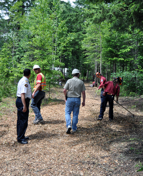
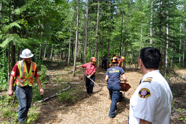
Under the guidance of Manager Brad Litke, initial attack teams from the Ministry of Forests’ firebase at the airport have, in cooperation with the City’s Fire Rescue Service and Parks and Recreation Department, cleared the undergrowth, bucked and for the most part stacked wood from the trees they have cut down for the use of neighbourhod residents. The waste they have generated has been chipped and laid down over a network of quite lovely little trails that now snake through the trees.
“This can give homeowners a clear idea of what they can achieve around their own properties,” Fire Chief Rob Girard said as he took me on a tour of the project. “It also improves the sight lines in here. People report bears and moose in here all the time and the last thing you want to do it walk right up on one.”
Litke said his crews have also cleaned up an amazing amount of garbage ranging from snowmobile parts to ordinary trash discarded by thoughtless people.
Girard said some people were obviously using the heavy brush as a place to smoke crack. Pipes, bongs and other drug-related detritus was found in a the woods.
“If I was a resident with children I’d be very concerned by the knowledge that people were up here lighting up and getting stoned,” he said.
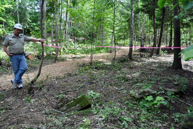
Of some historical interest may be the uncovering of what appear to be two graves with broken headstones outside the boundaries of Mountain View Cemetery. Girard said Revelstoke Museum’s Cathy English is looking into this.
Peter Hisch, a fuels management specialist with the Ministry of Forests, said the demonstration project, which is one of five being conducted in the South East Fire District, shows what can be accomplished with some basic tools — chainsaws, axes, mattocks and rakes — in the kind of fuel-heavy woods typical of this area.
“We don’t have the resources to clear the boundaries of all our towns,” Hisch said. “Even just this small area took a lot of cooperation between the Ministry of Forests, the City and the Fire Rescue Service. But if we can motivate private property owners to take care of the woods around their own properties we can make a difference.”
Certainly, what has been accomplished off Basford Drive must be seen to be believed. As Dave Manson, acting foreman of the City’s Parks and Recreation Department work crew, put it, “It looks a lot like a park, now.”
You can see what has been done by driving up Basford Drive from LaForme Boulevard. Stop when you see Greely Crescent on the right. There is a trail that snakes through the woods behind the homes on Greely. About 15 metres in is a sign that explains exactly what has been done.
It’s easy to believe that because Revelstoke is within the Interior Rainforest we are somehow either immune or less likely to be directly threatened by a wildfire than, say, Williams Lake. That’s certainly not borne out by the historical record with major fires here in 1911 and the 1930s and fires on Mackenzie in 2003 and Macpherson in 2005.
If you’d like to learn more, please click on one of the links below:
- Click here to read a draft summary of the Enhanced Wildfire Risk Mapping Report, including its recommendations.
- Click here to read the City’s Wildfire Protection Plan.
- Click here to find out more about FireSmart.
- Click here to read a previous story about this issue.
In the meantime, we hope you’ll enjoy these photos of the demonstration project:


