By David F. Rooney
It has been a long time since Revelstoke was seriously threatened by a major wildfire, but that doesn’t mean we can rest easy as the 2011 fire season approaches.

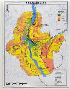
The city is surrounded by fuel-laden forests and it’s not a question of if they’ll go up in smoke, but when, says Archie McConnachie, one of the authors of a report that examines the risk of a major wildfire in our immediate area.
The fact that Revelstoke is in the midst of the Interior Rainforest is somewhat misleading. There have been two major fires here in the last 100 years – one in 1911 and another in the 1930s – as well as smaller fires most recently on Mount Mackenzie in 2003 and on Mount Macpherson in 2007.
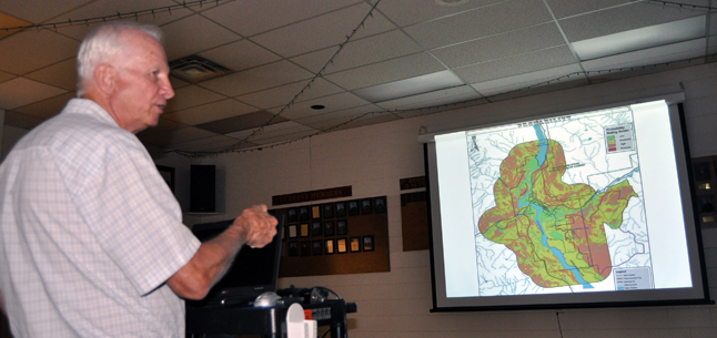
McConnachie, retired manager of the Revelstoke wildfire base and a member of the team that has produced a report entitled Wildfire Risk Mapping Enhancement to the Revelstoke Community Wildfire Protection Plan, told people who attended an open house at the Fire Hall last week that a significant wildfire on Mount Mackenzie at the right time – the 20 days in August when the forest is in a state of extreme risk – could wrap right around the mountain threatening Revelstoke Mountain Resort, Upper Arrow Heights, the Greeley Creek Water Treatment Plant, the Trans-Canada Highway, the CPR main line and Mountain Revelstoke National Park. Late summer is also the time when most resources are directed at fires elsewhere in the province.
That high wildfire probability in the RMR lands is due to the fuel-laden state of the forest on the flanks of the mountain, the fact that the prevailing winds in the summer are from the southwest, which “would drive it (a fire) towards town.”
Of course Revelstoke has some significant strengths such as:
- the fact that a local wildfire would be easily and swiftly detected;
- the city has a competent Fire Rescue Service;
- the close proximity of a BC Wildfire Management Base off Westside Road; and
- the presence of a Parks Canada fire fighting team.
The real risk of wildfire in the Revelstoke region makes it imperative that local homeowners bone up on the provincial FireSmart program and take steps to ensure that their property is as protected as they can make it.
Members of the public are invited to discuss the report with Fire Chief Rob Girard, the project team and Wildfire Committee members at open house presentations where the risk ratings and recommendations for the following neighbourhoods will be reviewed:
- Clearview and Johnson Heights – June 20, 7 pm at the Coast Hillcrest Hotel
- Arrow Heights and Airport Bench – June 27, 7 pm at the Arrow Heights School
- Begbie Bench – June 28, 7 pm at the Nordic Ski Lodge


